To celebrate Natura 2000 Day, students of 5th and 7th grade of Mazsalaca Secondary School took part in an educational…
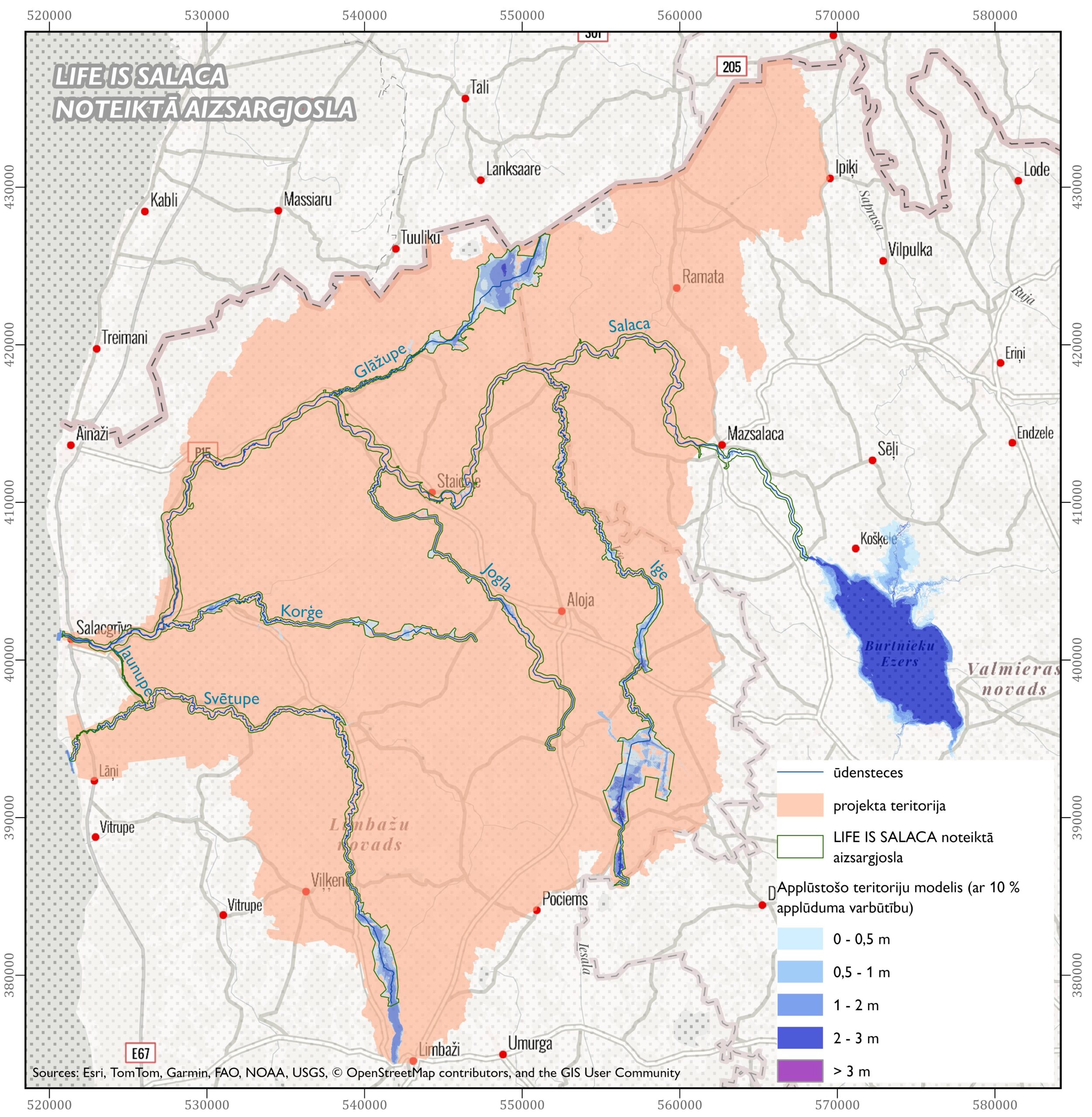
One of the expected outcomes of LIFE IS SALACA is the assessment of ecosystem services and its integration into sustainable land use modelling, which is being developed in seven project watercourses and their protection zones: Salaca, Jaunupe, Svētupe, Korģe, Jogla, Iģe and Głāžupe. The ecosystem services assessment area covers 60% of the territory of the Nature Park “Salaca Valley”, for which the LIFE IS SALACA project will start the development of a nature protection plan in 2026. The ecosystem services assessment will enable science-based decisions to be taken in the development of long-term and short-term measures for the protection and management of the protected area.
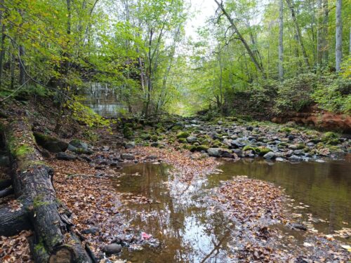
The choice of the water body’s protection zone as the study area for the ecosystem service assessment is not accidental, as it concerns an area that is dynamic, ecologically sensitive and rich in natural diversity. The protection zone is intended to protect the water body from unwanted external impacts.
It is essential that the protection zones are defined in a coherent way to ensure the most successful assessment of ecosystem services. Therefore, within the LIFE IS SALACA project, a data-based protection zone was established for the Salaca, Jaunupe, Svētupe, Korģe, Jogla, Iģe and Glāžupe, following the requirements of the Protection Zone Law and the Cabinet Regulation No 406 of 3 June 2008 “Methodology for the Determination of Surface Water Body Protection Zones”.
To establish the protection zone for the water bodies, a series of preparatory works were carried out to prepare the necessary geospatial data. The spatial location of the watercourses and the millponds was identified. For each water body, the upper boundary of its main bank was determined. To identify the slopes or parts of the slopes where the angle is greater than 25-30 degrees, a digital terrain slope model was used.
For the first time the data of the floodplain model (with 10% probability of flooding), developed with the financial support of LIFE IS SALACA project, have been used to define the protection zone for Salaca, Jaunupe, Svētupe, Korģe, Jogla, Iģe and Glāžupe. These data available for everyone to view in the LEGMC “Flood risk maps” at videscentrs.lvgmc.lv. Until then, data on this scale and format for the flooded areas of the Salaca, Jaunupe, Svētupe, Korģe, Jogla, Iģe, Glāžupe were not available, therefore the boundaries of their protection zones could not be correctly determined. The data from this model will serve as an important resource for informed planning of sustainable economic activities.
In addition, data on protected habitats of the European Union importance available in the nature data management system “Ozols” were assessed to include in the protection zone habitats related to the dynamic processes of the river, which could be indicative of periodic flooding or erosion risk (e.g. 6450 Northern boreal alluvial meadows, 8220 Siliceous rocky slopes with chasmophytic vegetation).
After compiling all the above-mentioned geospatial data, two approaches to the protection zone were developed, the first strictly adhering to the above-mentioned regulations, while the second approach broadens the protection zone to include the entire river valley, thus including areas related to the dynamic processes of the river for the assessment of ecosystem services.
The process of defining the protection zones has been documented, so that the description of the protection zones can be used by any stakeholder faced with the development of protection zone regulations or the practical definition of the protection zone. The description of the definition of the protection zones also identifies several shortcomings in the methodology of the above-mentioned legislation. For example, there is a lack of a clear approach to defining the protection zone for large river valleys where there are multiple overbank terraces.
The area of the LIFE IS SALACA project is in two administrative territories – Limbaži and Valmiera municipalities. During the development phase of the ecosystem services assessment method, new spatial plans for both municipalities were under preparation. This meant that the new boundaries of the water body protection zones had not yet been finalized and incorporated into the spatial plans. LIFE IS SALACA therefore had the opportunity to present its defined protection zone and its baseline data to both Valmiera and Limbaži municipalities. LIFE IS SALACA would like to point out that the protection zone established by the project is not legally binding but a recommendation; thus, it is the decision of the municipality to decide on the boundary of the protection zone to be depicted in the spatial plan.
During the process of defining the protection zone for water bodies, communication was carried out not only with the LIFE IS SALACA project partners, but also with several stakeholders – the State Environmental Service, Nature Conservation Agency, Ministry of Climate and Energy, as well as with the municipalities of Valmiera and Limbaži.