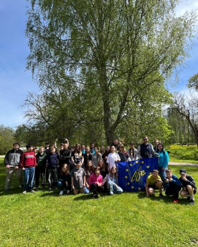
To celebrate Natura 2000 Day, students of 5th and 7th grade of Mazsalaca Secondary School took part in an educational…
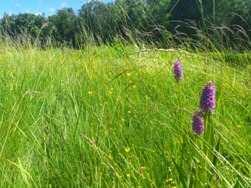
The Latvian Fund for Nature has nominated the edge as the 2025 Habitat of the Year. It’a transition zone between two or more ecosystems. In the project LIFE IS SALACA, the most relevant is the odge of the water or the riverside. It is an overlapping area between aquatic and terrestrial environments and is therefore characterised by particularly high biodiversity.
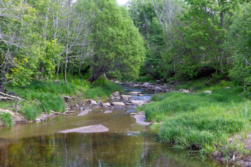
The largest rivers in the pilot area – the Salaca, Korģe, Korģīte, Svētupe, Jaunupe, Ramata, Glāžupe, Jogla, Iģe and Pužupe – cover a total length of 334 km. If both banks are considered, the total length of the rivers is almost 700 km. In addition to these rivers, there are other much smaller rivers which also form various ecologically valuable riversides. The width of the riversides can vary from a few metres to over ten metres, depending on the size of the river.
What’s happening on the riverside?
A riverbank is a place where land and water overlap, and where processes essential to both ecosystems take place. A natural riparian zone of grassland, pastures and forests provides a diverse habitat for many species of plants and animals. The coast is a hiding and migratory place for terrestrial organisms. The coast is also a habitat and feeding ground for aquatic organisms. Birds, insects, butterflies and beetles feed, nest and live along the water’s edge. The aquatic environment is also important for amphibians, which survive the egg and chrysalis stages in the water and move to land as adults. Rivers and their shores are also a corridor for the movement or migration of aquatic organisms.
In areas dominated by arable land and with little natural habitats left, the river and its riparian zone are almost the only refuge for wild plants and animals and a migration corridor that ensures the stability and reproduction of species populations. Of course, the riparian zone can only fulfil these functions if it is not ploughed up to the riverbank.
How does the riverside affects conditions in the river?
The riparian zone also influences river conditions. Riparian zones maintain the water temperature regime, regulate the rate of photosynthesis and provide nutrients to the river. The alternation of sunny and shady stretches allows the river to develop adequate vegetation cover. In heavily shaded stretches, plants are absent and the food base for aquatic inhabitants is therefore also lacking. In fully lit stretches of the river, on the other hand, aquatic plant cover may be too high. In fast-flowing stretches, the best ratio of shaded to sunny stretches is 70:30, and in slow-flowing stretches 50:50.
Riparian vegetation influences the aquatic ecosystem not only by shading, but also by strengthening banks and limiting erosion. The root system of trees and herbaceous plants strengthens the banks and reduces the washing of soil particles into the river.
How is it possible to help preserve biodiversity on riversides?
Rivers are diverse and so are their riparian areas, so each situation is individual. However, there are universal recommendations that always work.
A natural riparian zone should be maintained along the river, with vegetation such as grass or a tree belt, including mosaic shading. If fields are ploughed right up to the riverbank, nutrients from the soil leach into the river, contributing to overgrowth and sedimentation. If nutrients are released into the water, neither mowing nor other activities will help in the long term – the primary need is to keep the river clean. The wider the natural strip on the riverbank, the less likely it is that pollution from land will reach the river.
It is recommended to plant long-lived deciduous trees with a stable root system, such as oaks, along the riverbank. The roots of the trees will strengthen the banks, reducing erosion and nutrient inputs.
It is common practice to place compost heaps and toilets as far “out of sight” as possible, which is very often right at the river’s edge. However, spills from small toilets without isolated bins and compost heaps pollute the water. In turn, a polluted river becomes more overgrown and unattractive to wildlife and people.
Rivers and their coasts serve as migration corridors not only for native species, but also for non-native species, including invasive species. The dumping of weeds, biomass and compost near rivers is a frequent cause of extensive invasive species growth – viable plant parts travel downstream and rapidly invading large areas.
To avoid bank erosion, riverbanks should not be heavily grazed. Grazing leads to soil leaching into the river, which can contribute to both sedimentation and nutrient transport into the river, which in turn can result in increased river siltation. It is better that livestock cannot access the river along the entire length of the bank, but only in some of the gentler areas. To ensure selective grazing of livestock along the riverbank, it is preferable to regulate grazing with a mobile electric shepherd.
It is important to remember that the river should not be used as a bathroom. Washing cars, pets or people themselves in the river with various detergents is very harmful to the water and the creatures that live in it. Bathing on the banks of rivers and lakes also puts additional pressure on the water. It is important to make sure that untreated wastewater does not enter the river.
And of course, when relaxing in nature, be careful not to leave rubbish in the river or on its banks!
Do you know how diverse the riversides of the Salaca sub-basin are?
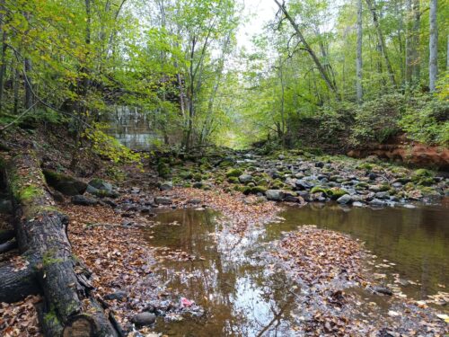
The Salaca sub-basin includes rivers ranging from small streams to the mighty Salaca. Therefore, the riversides are also very diverse. Forests are widespread along the banks of the rivers of the Salaca basin. These range from slope and ravine forests to alluvial forests on the banks of the Korģe, Salaca and Svētupe, as well as old and natural boreal forests on the banks of the Iģe. Although forests are the most frequent habitats along the banks of the rivers of the Salaca sub-basin, it is certainly worth mentioning the grasslands that are most abundant along the banks of the Salaca, Korģe and Iģe. Floodplain grasslands – regularly flooded areas with variable soil moisture and fertility conditions – have a particularly close relationship with rivers. But in addition to floodplain grasslands, dry and moderately wet grasslands can also be found along the banks of the rivers in the Salaca sub-basin.
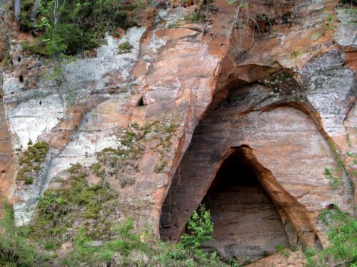
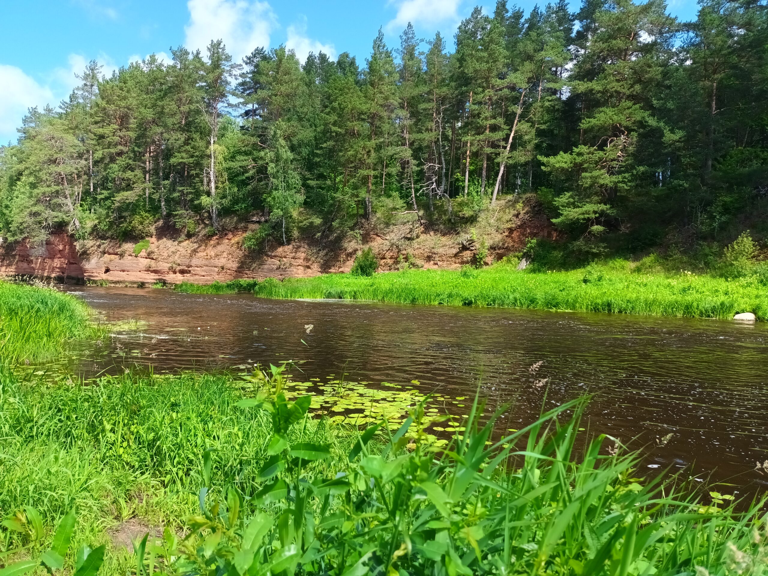
Many sandstone outcrops, such as Pietraga Sarkanās Klintis, Neļķu klintis or Skaņaiskalns, decorate the banks of the Salaca. Several sandstone outcrops are also found on the banks of the Iģe and Pužupe rivers. On the banks of the Korģe and the Głažupe, agricultural land adjoins the river in places. The riverbanks may also be heavily modified, for example in the port of Salacgrīva in the lower reaches of the Salaca River. The lower part of the Svētupe coastline, on the other hand, has remained natural, with both forested coastal dunes and sandy beaches with perennial vegetation on its shores.